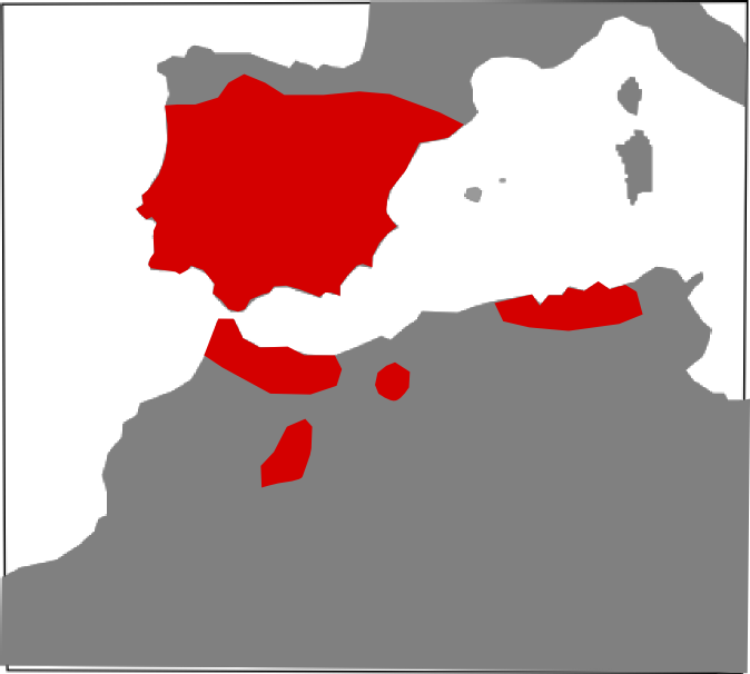
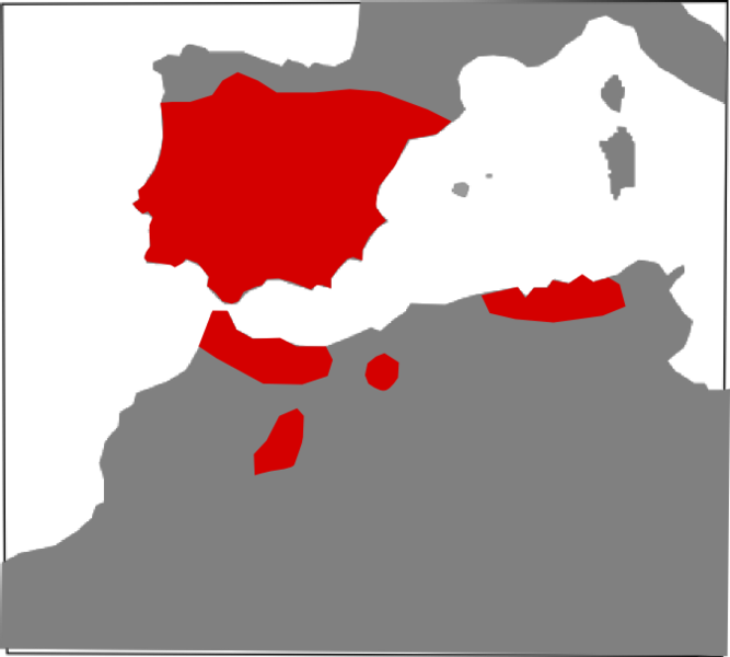
Vipera_latastei_range_Map.png
Size of this preview:
667 × 600 pixels
.
Other resolutions:
267 × 240 pixels
|
534 × 480 pixels
|
674 × 606 pixels
.
Summary
| Description |
English:
Vipera latastei range map.
Español:
Mapa de distribución de Vipera latastei.
|
| Date | |
| Source | Wikimedia Commons |
| Author | Carlos Bartolomé La Huerta |
|
Permission
( Reusing this file ) |
This file is licensed under the
Creative Commons
Attribution 3.0 Unported
license.
|
| Other versions |
Carlos Bartolomé La Huerta |
Licensing
This file is licensed under the
Creative Commons
Attribution-Share Alike 3.0 Unported
license.
-
You are free:
- to share – to copy, distribute and transmit the work
- to remix – to adapt the work
-
Under the following conditions:
- attribution – You must give appropriate credit, provide a link to the license, and indicate if changes were made. You may do so in any reasonable manner, but not in any way that suggests the licensor endorses you or your use.
- share alike – If you remix, transform, or build upon the material, you must distribute your contributions under the same or compatible license as the original.