Wagah-Attari_(OpenStreetMap).png

Size of this preview:
800 × 511 pixels
.
Other resolutions:
320 × 204 pixels
|
640 × 409 pixels
.
| Description |
This map was created from
OpenStreetMap
project data, collected by the community.
This map may be incomplete, and may contain errors. Don't rely solely on it for navigation.
|
| Date | (see file history) |
| Source | You may find a page on the OpenStreetMap wiki page for Wagah-Attari |
| Creator |
OpenStreetMap contributors
|
|
Permission
( Reusing this file ) |
OpenStreetMap data and maps are licensed under the
Creative Commons
Attribution-ShareAlike 2.0 license (CC-BY-SA 2.0).
This file is licensed under the
Creative Commons
Attribution-Share Alike 2.0 Generic
license.
|
| Georeferencing | If inappropriate please set warp_status = skip to hide. |
Summary
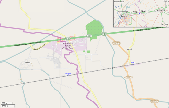
- Source link: OSM map page of Wagah and Attari area . Plus source for the image in the upper corner
- Note: derivative work (addition of a map in the corner with "Wagah" and "Attari" names)
-
English: Map showing the bordering villages of Wagah (Pakistan) and Attari (India). There are shown Wagah and Attari railway stations, the Indo-Pakistani border, the checkpoints and the Wagah border crossing, on the Grand Trunk Road, in which took place the Wagah border ceremony . In the upper corner is shown the position of the two villages between the cities of Lahore, Pakistan, and Amritsar, India.