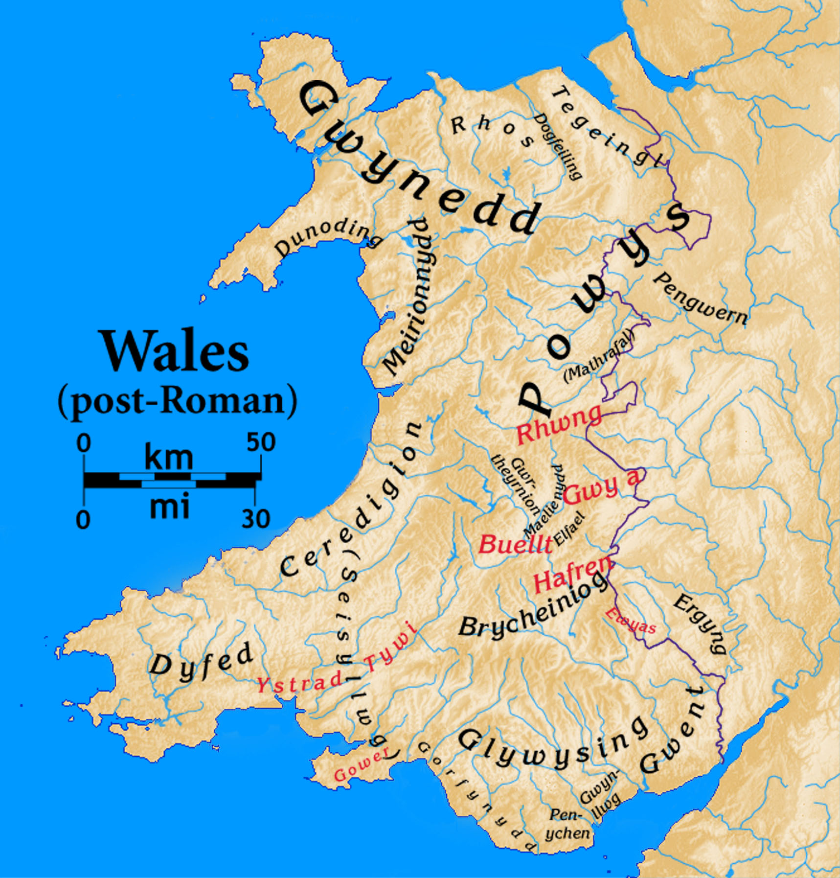
Wales.post-Roman.jpg
Size of this preview:
574 × 600 pixels
.
Other resolutions:
230 × 240 pixels
|
459 × 480 pixels
|
735 × 768 pixels
|
980 × 1,024 pixels
|
1,717 × 1,794 pixels
.
| Description | Post-Roman and Early Medieval Wales | ||
| Date | |||
| Source |
sub area of
Image:Uk topo en.jpg
plus my additions
Data on peoples and their location is from John Edward Lloyd 's 1912 History of Wales (2 vols.) |
||
| Author | author of source image, plus my additions (myself) | ||
| Other versions |
|


I, the copyright holder of this work, hereby publish it under the following license:
This file is licensed under the
Creative Commons
Attribution-Share Alike 3.0 Unported
license.
-
You are free:
- to share – to copy, distribute and transmit the work
- to remix – to adapt the work
-
Under the following conditions:
- attribution – You must give appropriate credit, provide a link to the license, and indicate if changes were made. You may do so in any reasonable manner, but not in any way that suggests the licensor endorses you or your use.
- share alike – If you remix, transform, or build upon the material, you must distribute your contributions under the same or compatible license as the original.