WalkerExpeditionMarker.jpg
Size of this preview:
800 × 424 pixels
.
Other resolutions:
320 × 170 pixels
|
640 × 340 pixels
|
1,024 × 543 pixels
|
1,280 × 679 pixels
|
1,960 × 1,040 pixels
.
Summary
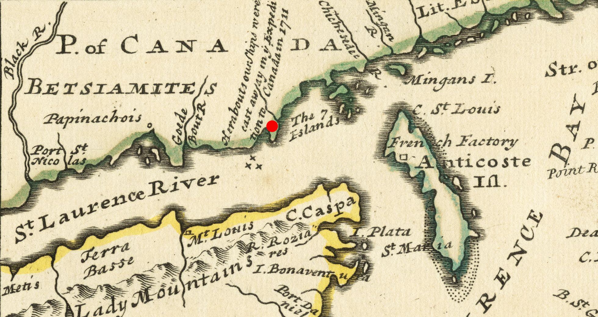
| Description | A period map marked with the site of the 1711 Quebec Expedition naval disaster. | |||||||||||||||||||||||
| Date | ||||||||||||||||||||||||
| Source |
From the Boston Public Library digital map collection: http://maps.bpl.org/details_14080/ Call Number: G3400 1732 .M65 |
|||||||||||||||||||||||
| Author |
|
|||||||||||||||||||||||

Licensing
|
This is a faithful photographic reproduction of a two-dimensional,
public domain
work of art. The work of art itself is in the public domain for the following reason:
The official position taken by the Wikimedia Foundation is that "
faithful reproductions of two-dimensional public domain works of art are public domain
".
This photographic reproduction is therefore also considered to be in the public domain in the United States. In other jurisdictions, re-use of this content may be restricted; see Reuse of PD-Art photographs for details. |
||||