Wandlebury.jpg
No higher resolution available.
Summary
| Description |
English:
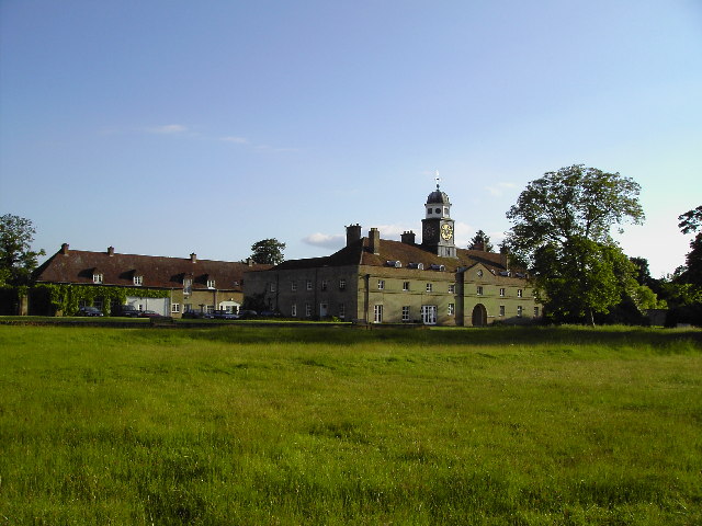
Cupola stable block, Wandlebury Ring Wandlebury Iron Age hillfort occupies a prominent position below the crest on the south facing slope of Gog Magog Hill. This early 18th century stable block (now converted to housing) is all that remains of the Mansion House built within the fort. Inside the block is the grave of 'The Godolphin Arabian'.
The Cambridge Preservation Society acquired the Wandlebury Estate in 1954.
|
| Date | |
| Source | From geograph.org.uk |
| Author | David Lamkin |
| Camera location |
|
View this and other nearby images on: OpenStreetMap |
|
|---|
Licensing

|
This image was taken from the
Geograph project
collection. See
this photograph's page
on the Geograph website for the photographer's contact details. The copyright on this image is owned by
David Lamkin
and is licensed for reuse under the
Creative Commons
Attribution-ShareAlike 2.0 license.
|
This file is licensed under the
Creative Commons
Attribution-Share Alike 2.0 Generic
license.
Attribution:
David Lamkin
-
You are free:
- to share – to copy, distribute and transmit the work
- to remix – to adapt the work
-
Under the following conditions:
- attribution – You must give appropriate credit, provide a link to the license, and indicate if changes were made. You may do so in any reasonable manner, but not in any way that suggests the licensor endorses you or your use.
- share alike – If you remix, transform, or build upon the material, you must distribute your contributions under the same or compatible license as the original.