Wanita_Sebagai_Juru_Damai_Perang_Antar_Suku_di_Pulau_Enggano_-_panoramio.jpg
No higher resolution available.
| Description |
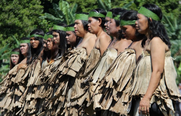
Wanita Sebagai Juru Damai Perang Antar Suku di Pulau Enggano Tari Perang adalah pagelaran kebudayaan yang mengisahkan pertempuran antar suku dalam memperebutkan wilayah kekuasaan, dimana peran para wanita sangat penting dalam perdamaian pertikaian antar suku. Sebuah pertunjukan kebudayaan tradisional seusai upacara HUT RI di Desa Apoho, Pulau Enggano, Bengkulu Utara, Bengkulu, Rabu (17/8/2016). Para ibu-ibu dan wanita membentuk barisan melingkar mengepung para pria yang sedang bertempur, hal inilah yang menyebabkan dan berakhir dengan sebuah perdamaian. Tarian perang ini diperankan oleh 100 pemuda-pemudi warga suku asli Enggano. [Rizky. T] |
||
| Date | (original upload date) | ||
| Source | https://web.archive.org/web/20161103035458/http://www.panoramio.com/photo/133762671 | ||
| Author | Lentera Merah | ||
|
Permission
( Reusing this file ) |
This file is licensed under the
Creative Commons
Attribution-Share Alike 3.0 Unported
license.
Attribution:
Lentera Merah
|
| Camera location |
|
View this and other nearby images on: OpenStreetMap |
|
|---|