War_in_donbass.svg

Size of this PNG preview of this SVG file:
427 × 599 pixels
.
Other resolutions:
171 × 240 pixels
|
342 × 480 pixels
|
547 × 768 pixels
|
729 × 1,024 pixels
|
1,459 × 2,048 pixels
|
570 × 800 pixels
.
Summary
| Description |
English:
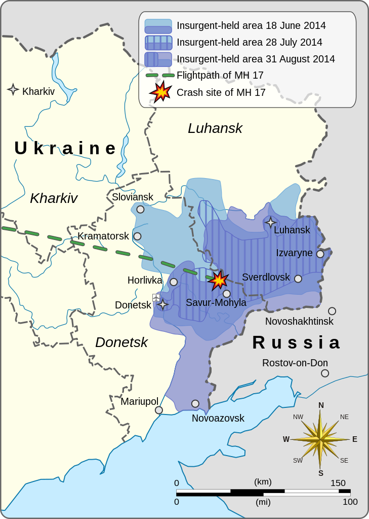
This is a map of the War in Donbass. It shows the expansion and contraction of pro-Russian insurgent-held areas over the duration of the conflict, starting with 18 June 2014, then as of 28 July, and finally as of 31 August. It also depicts the flightpath and crash-site of Malaysia Airlines Flight 17.
|
||||||||||||||||||||||||||||||||||
| Date | |||||||||||||||||||||||||||||||||||
| Source |
Own work based on:
Europe laea location map.svg
|
||||||||||||||||||||||||||||||||||
| Author | Goran tek-en | ||||||||||||||||||||||||||||||||||
|
Permission
( Reusing this file ) |
This file is licensed under the
Creative Commons
Attribution-Share Alike 4.0 International
license.
Attribution:
Goran tek-en
|
||||||||||||||||||||||||||||||||||
| Other versions |
|
||||||||||||||||||||||||||||||||||
| SVG development |
This
vector image
was created with
Inkscape
.
|
||||||||||||||||||||||||||||||||||


.svg)
| Object location |
|
View this and other nearby images on: OpenStreetMap |
|
|---|

