Washington_State_Route_294_topo_(1966).png
Size of this preview:
800 × 436 pixels
.
Other resolutions:
320 × 174 pixels
|
640 × 349 pixels
|
1,254 × 683 pixels
.
| Description |
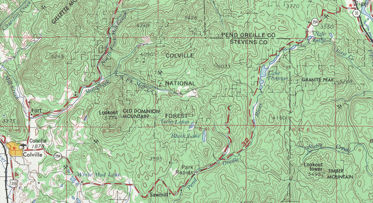
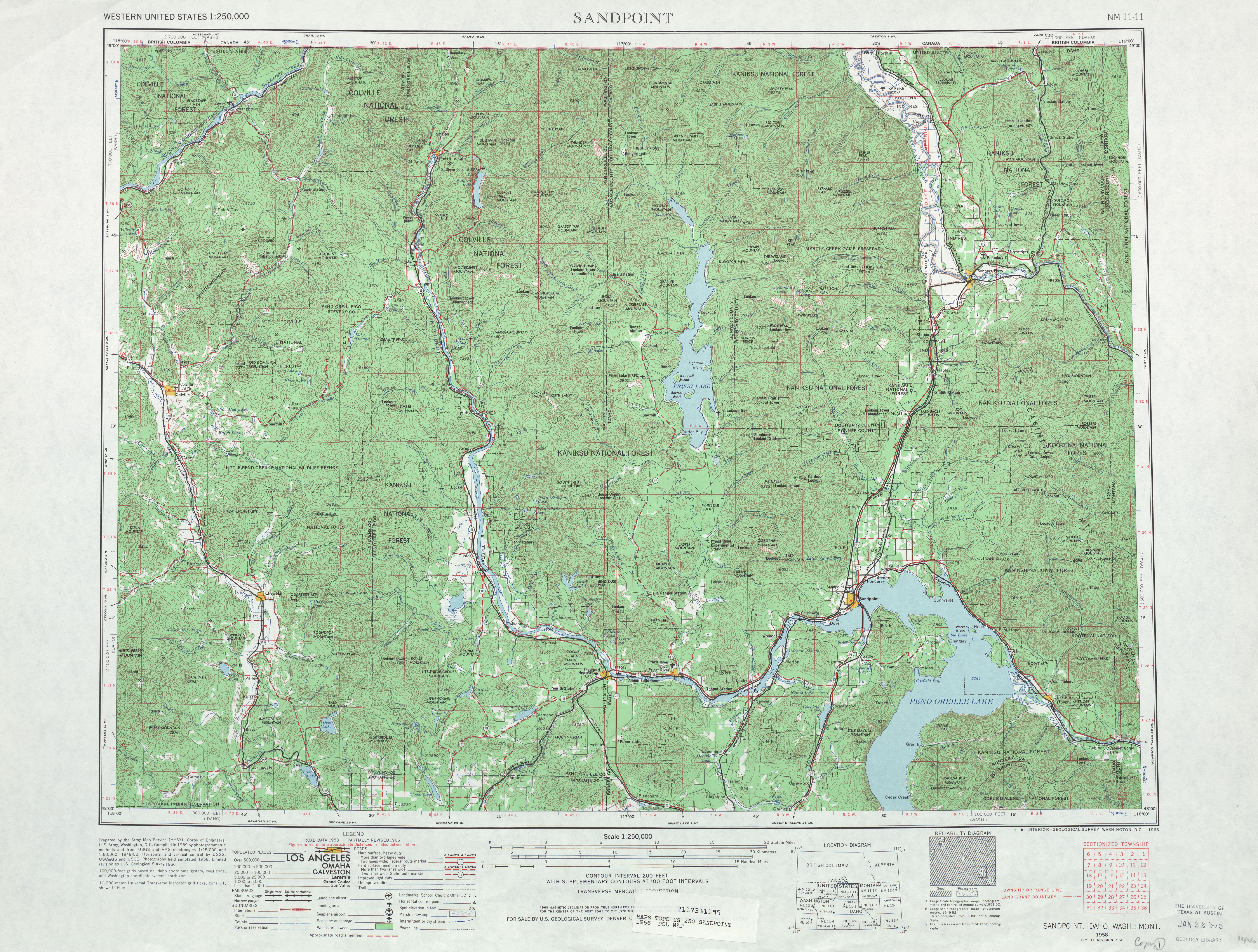
English:
A map showing the original route of
Washington State Route 294
in 1966, including the gap.
|
|||
| Date | ||||
| Source | USGS Map: Sandpoint, 1966 | |||
| Author | United States Geological Survey | |||
|
Permission
( Reusing this file ) |
|