Waterways_New_York_City_Map_Julius_Schorzman.png
Size of this preview:
616 × 600 pixels
.
Other resolutions:
247 × 240 pixels
|
493 × 480 pixels
|
789 × 768 pixels
|
1,052 × 1,024 pixels
|
2,104 × 2,048 pixels
|
2,652 × 2,582 pixels
.
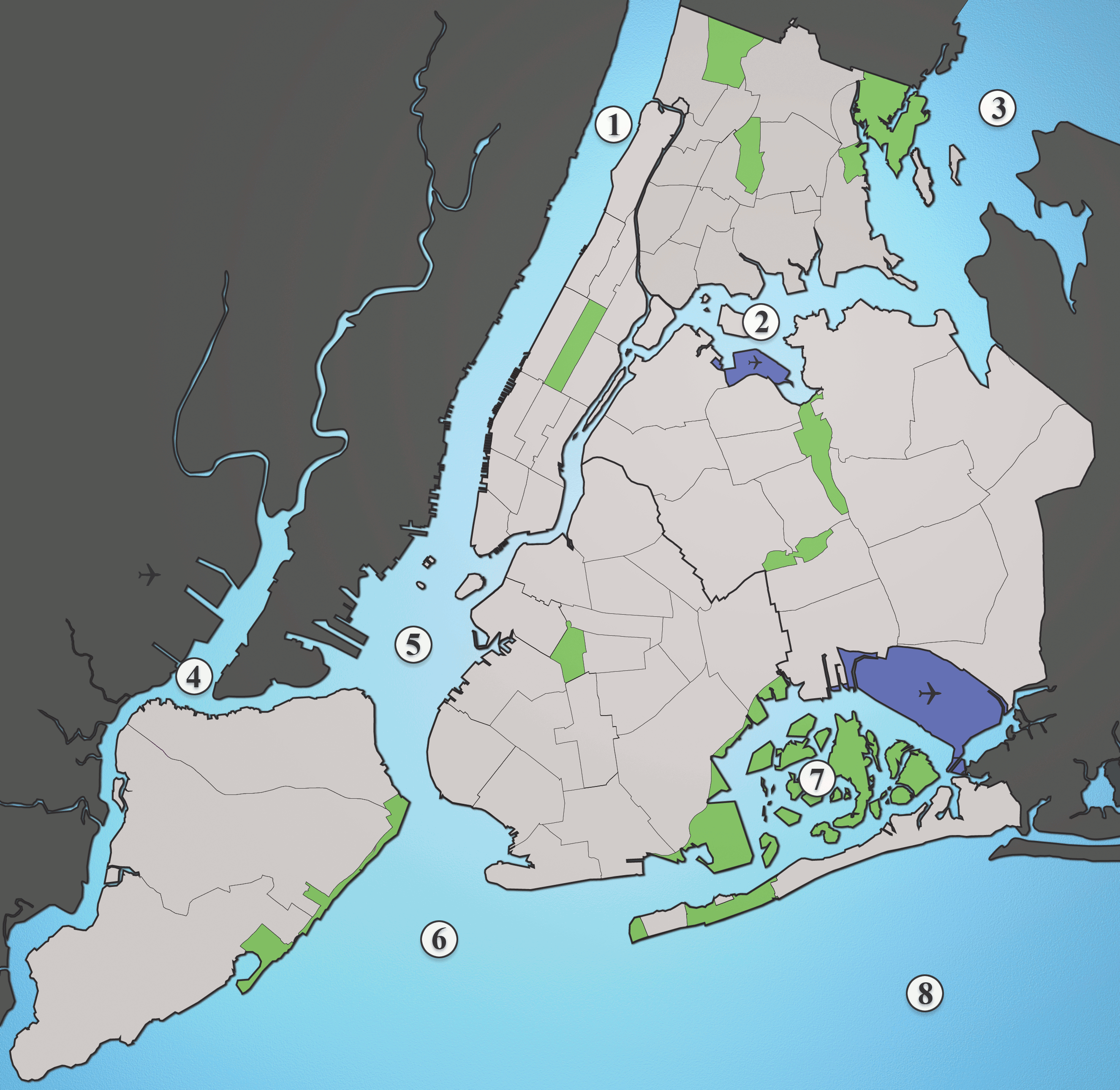
A map showing the major waterways in New York City.
- Hudson River
- East River
- Long Island Sound
- Newark Bay
- Upper New York Bay
- Lower New York Bay
- Jamaica Bay
- Atlantic Ocean
Source: I created this image myself using various maps and images as source material. (Please include the Spuyten Duvil)
This file is licensed under the
Creative Commons
Attribution-Share Alike 2.5 Generic
license.
-
You are free:
- to share – to copy, distribute and transmit the work
- to remix – to adapt the work
-
Under the following conditions:
- attribution – You must give appropriate credit, provide a link to the license, and indicate if changes were made. You may do so in any reasonable manner, but not in any way that suggests the licensor endorses you or your use.
- share alike – If you remix, transform, or build upon the material, you must distribute your contributions under the same or compatible license as the original.