Western_Front_1917.jpg
Size of this preview:
775 × 600 pixels
.
Other resolutions:
310 × 240 pixels
|
620 × 480 pixels
|
993 × 768 pixels
|
1,242 × 961 pixels
.
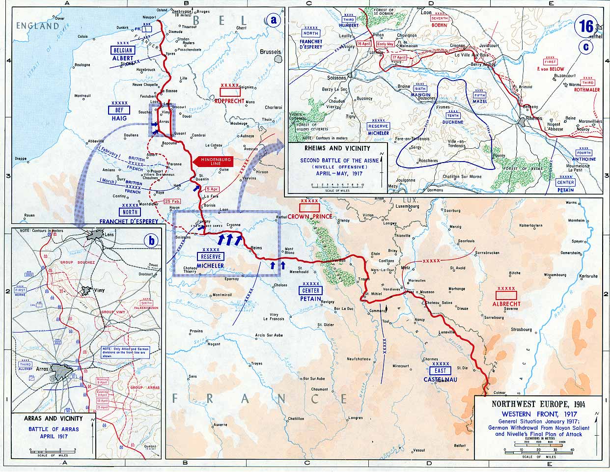
| Description | Map of the Western Front , 1917 . The red line marks the front as of 5 April 1917. The Siegfriedstellung or Hindenburg Line, only ran from Arras to Laffaux (shown in insert) on the river Aisne - essentially the portion to the east of the dotted red line marking the 25 February front. | |||
| Date | ||||
| Source | Campaign Atlas to the Great War (specifically 16. Western Front, 1917, The Battle of Arras and the Second Battle of the Aisne ) | |||
| Author | United States Military Academy’s Department of History [1] | |||
|
Permission
( Reusing this file ) |
|
|||
| Other versions | Derivative works of this file: USMA - Battle of Arras - Vimy Ridge derivative.png |

|
|
This file was reviewed on 1 June 2009 by the
administrator
or
trusted user
Jappalang
(
talk
)
, who confirmed the
Public Domain
status on that date.
|
Transfer history
First uploaded in English Wikipedia as en:Image:Western_Front_1917.jpg by en:User:Ghepeu (10:53, 13 January 2006 . . Ghepeu (Talk) . . 1242x961 (233585 bytes))