White_Mountains2010-08-20.JPG

Size of this preview:
800 × 354 pixels
.
Other resolutions:
320 × 142 pixels
|
640 × 283 pixels
|
1,024 × 453 pixels
|
1,280 × 566 pixels
|
4,190 × 1,853 pixels
.
Summary
| Description |
English:
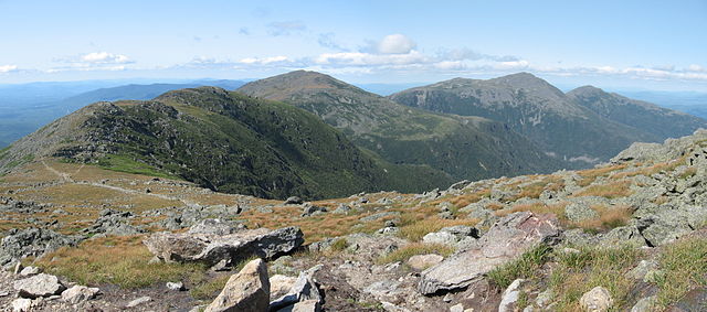
The northern section of the Presidential Range in New Hampshire's White Mountains. Viewed from the northwest side of Mount Washington. From left to right are Mount Clay, Mount Jefferson, Mount Adams, and Mount Madison.
|
| Date | |
| Source | Own work |
| Author | Fredlyfish4 |
| Camera location |
|
View this and other nearby images on: OpenStreetMap |
|
|---|
Licensing
I, the copyright holder of this work, hereby publish it under the following license:
This file is licensed under the
Creative Commons
Attribution-Share Alike 4.0 International
license.
-
You are free:
- to share – to copy, distribute and transmit the work
- to remix – to adapt the work
-
Under the following conditions:
- attribution – You must give appropriate credit, provide a link to the license, and indicate if changes were made. You may do so in any reasonable manner, but not in any way that suggests the licensor endorses you or your use.
- share alike – If you remix, transform, or build upon the material, you must distribute your contributions under the same or compatible license as the original.
| File created by Fredlyfish4 |
|
|
Permission is granted for use under
CC BY-SA 4.0
(or a similar license) for this file created by the author.
Please let the author know
if you use this work outside of Wikimedia projects
by sending an email to
|
|
|
This image has been assessed using the
Quality image guidelines
and is considered a
Quality image
.
|
| Annotations | This image is annotated: View the annotations at Commons |