Worcester_&_Birmingham,_&_Droitwich_Canal_map.png

Size of this preview:
445 × 600 pixels
.
Other resolutions:
178 × 240 pixels
|
356 × 480 pixels
|
570 × 768 pixels
|
1,156 × 1,558 pixels
.
Summary
| Description |
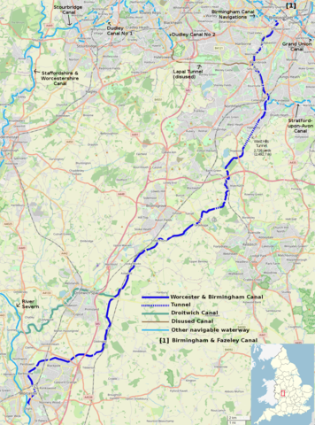
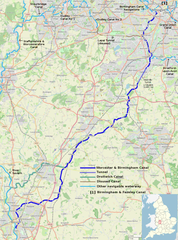
Map of the Worcester & Birmingham and Droitwich Canals, and connecting waterways.
This map was created from
OpenStreetMap
project data, collected by the community.
This map may be incomplete, and may contain errors. Don't rely solely on it for navigation.
|
|||
| Date | ||||
| Source | openstreetmap.org | |||
| Creator |
Own work, derived from open street map.
OpenStreetMap contributors
|
|||
|
Permission
( Reusing this file ) |
OpenStreetMap data is available under the Open Database License ( details ). Standard style map tiles are licensed as ODbL Produced Works.
|
|||
| Georeferencing | If inappropriate please set warp_status = skip to hide. |