WorldCrustalAge_-_Hawaii_hotspot.png

Size of this preview:
800 × 528 pixels
.
Other resolutions:
320 × 211 pixels
|
640 × 422 pixels
|
1,024 × 676 pixels
|
1,364 × 900 pixels
.
Summary
| Description |
English:
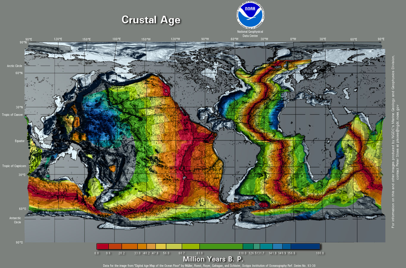
1997 Map of ocean floors, colors indicate differences in age.
1. - Mendocino Fracture Zone 2. - Bend in Hawaii hotspot trail 3. - Hawaii hotspot |
|||
| Date | ||||
| Source | http://www.ngdc.noaa.gov/mgg/image/crustalimages.html (specifically http://www.ngdc.noaa.gov/mgg/image/images/WorldCrustalAge.jpg ) | |||
| Author | Dr. Peter Sloss, NGDC | |||
|
Permission
( Reusing this file ) |
|
|||
| Other versions | File:WorldCrustalAge.png , file:Earth seafloor crust age 1996.gif |