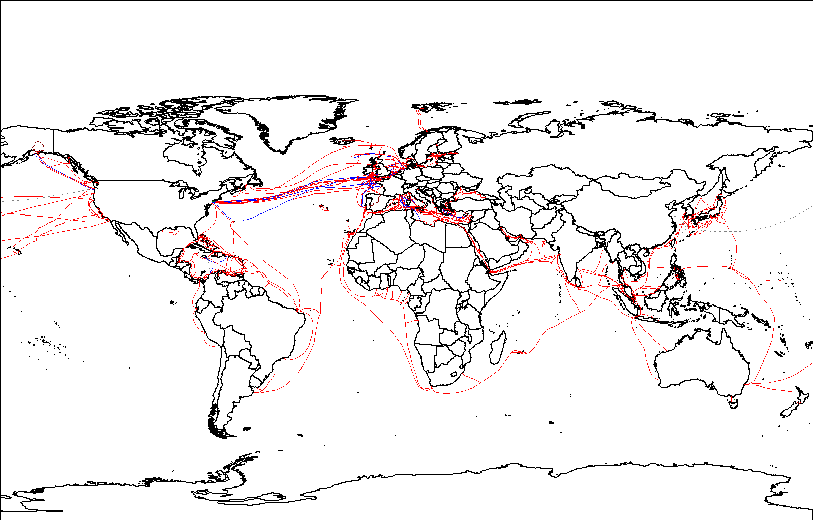
World_map_of_submarine_cables.png
Size of this preview:
800 × 512 pixels
.
Other resolutions:
320 × 205 pixels
|
640 × 410 pixels
|
1,024 × 656 pixels
|
1,280 × 819 pixels
|
1,601 × 1,025 pixels
.

|
This
economic map
image could be re-created
using
vector graphics
as an
SVG
file
. This has several advantages; see
Commons:Media for cleanup
for more information. If an SVG form of this image is available, please upload it and afterwards replace this template with
{{

vector version available

|

new image name

}}
.
It is recommended to name the SVG file “World map of submarine cables.svg”—then the template Vector version available (or Vva ) does not need the new image name parameter. |
| Description |
English:
Map showing
submarine telecommunication cables
around the world in 2007. (See
this map
, for later cables).
|
||
| Date | |||
| Source | Originally uploaded with the filename Submarine cables.png , overwriting the previous version. That version was restored so this is now being uploaded with a different filename. | ||
| Author | Rarelibra | ||
|
Permission
( Reusing this file ) |
|
||
| Other versions |
|
